SNOWY SHAQSHA – OLLEROS
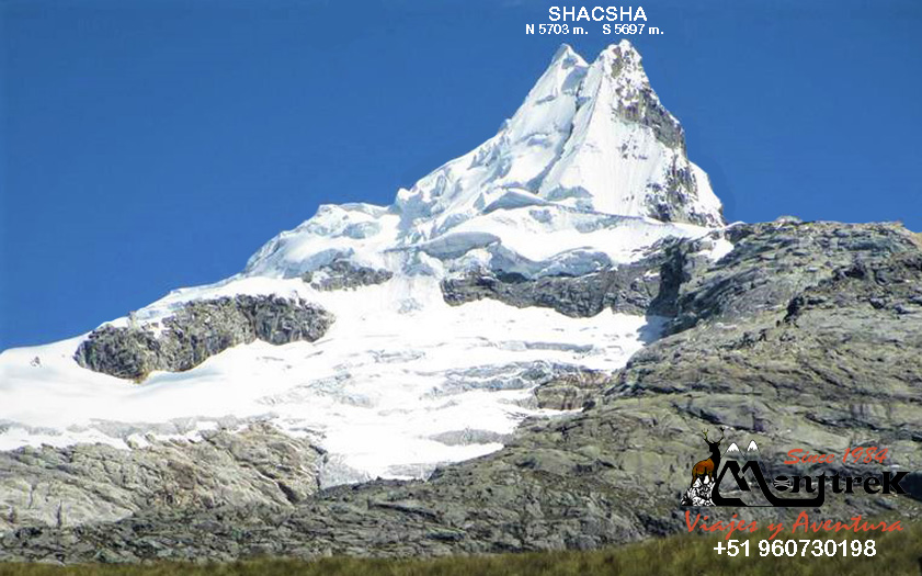
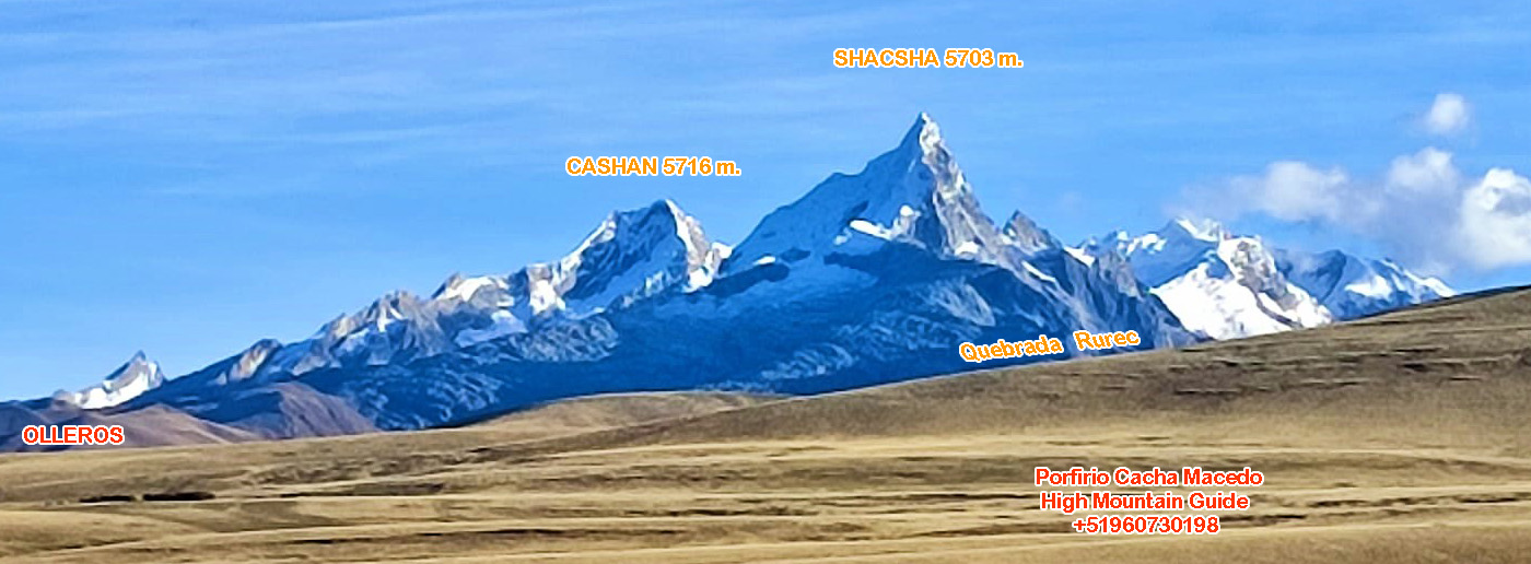
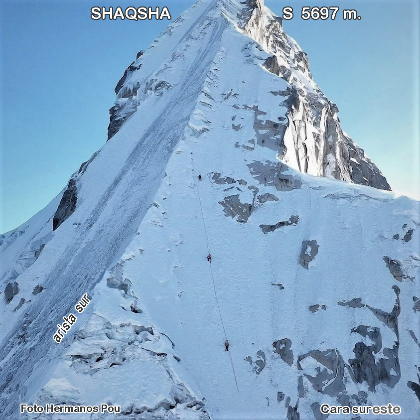
Shacsha (Shaqsha is the correct spelling) is a mountain located in the Cordillera Blanca in the Andes of Peru, approximately 5,703 meters (18,711 ft) high (northern peak and southern peak 5,697 meters (18,478 ft)). It is located in the Ancash region, Huaraz province, Olleros district. The Shacsha mountain is located southwest of the Huantsán mountain, and to the west of the Uruashraju mountain and southeast of the city of Huaraz.
When you come from Lima, from Catac you can see the Cordillera Blanca, and one of the first images of this chain of snow-capped mountains that capture our attention is the Shaqsha snow-capped mountain, due to its slender shape that is far from the others and is not a classic. to be climbed. Indeed, Shaqsha's strange paradox; Although most mountaineers set their eyes on it and fall in love with it, there are few lucky ones chosen to climb each summer season.
Immaculate and slender, the snowy Shaqsha can be seen next to the snowy peaks of Cashan, Rurec, Tuctupampa, the towers of Rurec and the magnificent Huantsan, a six thousand that gives its name to the southern area of the chain (Huantsan Group; even, Shaqsha himself is sometimes referred to as Huantsan Chico). From its vertiginous summit it is also possible to see the almost mythological Huayhuash mountain range in the distance with its difficult and sculptural snow-capped peaks.
ORIGIN OF THE NAME SHAQSHA
The toponymy of this snow-capped mountain is still a matter of debate among scholars. One version states that shaqsha comes from the Quechua word SAQSAS which means LONG HAIR, another version corresponds to a dance with bells on the legs, very common to see at patron saint festivals. Others, however, defend the thesis that shaqsha is a derivative of the Quechua word shaqshar, which would mean CHEWING THE COCA LEAF.
CLOSE UP
This beautiful snow-capped mountain is oblivious to crowds, and due to its easy access it invites all climbers to a calm ascent (few climbers go), silent, with beautiful technical difficulties of good ice and good granite rock. From the city of Huaraz, transportation is hired to the beautiful town of Olleros, where the services of the muleteer and donkeys are taken. After a good climb in intense cold, on your return you can take advantage of the thermal baths located in Olleros itself.
Current routes:
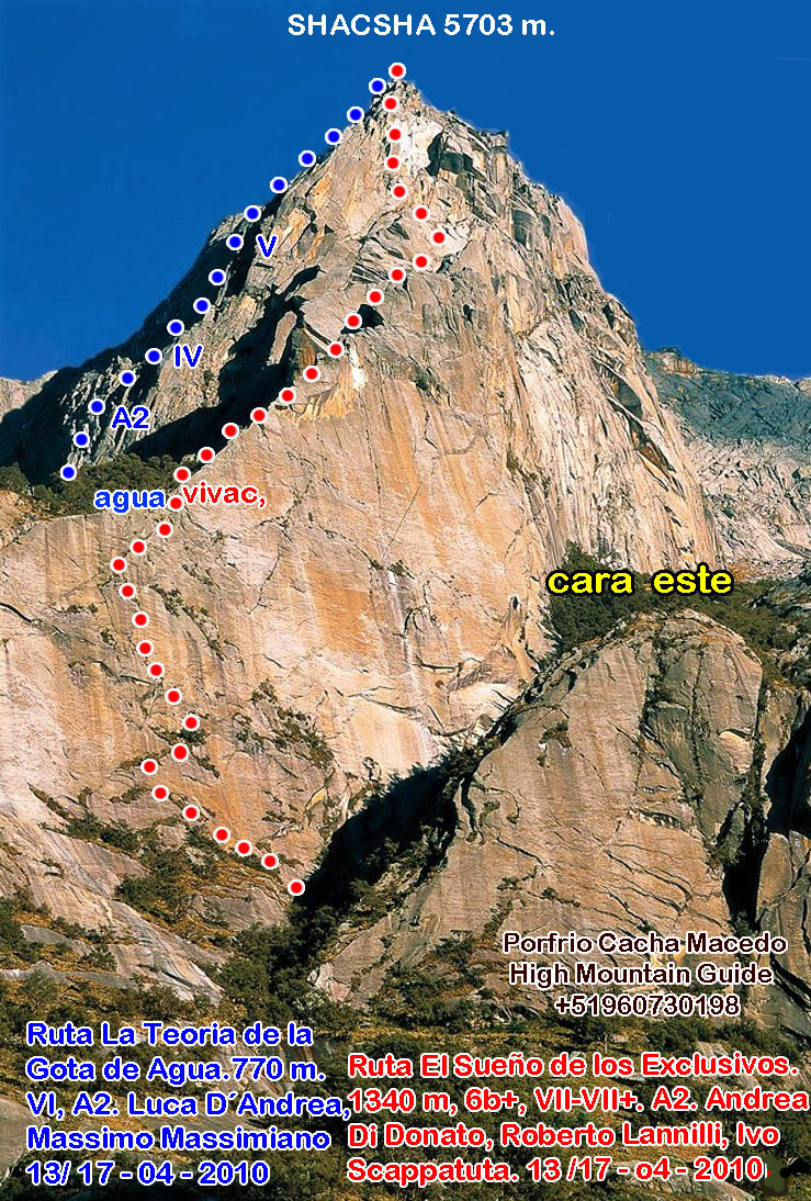
° Northeast ridge, 1958 route, by M. Chancy, Y. D'aubigne, M. Emslie, H. Simpson and W. Wallace.
° South peak west face, by H. Martens and J. Maardalen, July 1988. AD+/ D, 45°- 60°, 500 m.
° North peak west face (northwest slopes), by DM Sharman, August 14, 1991. AD, 500 m.
° North Peak West Face, Brad Johnson and A. Kolff, August 11, 1997. AD Difficulty,
° South peak. Southeast face “La via del Gemellaggio Yanet e Kristine”, Cesar Rosales, Miguel Martínez, Elías Flores and Tiziano Orio, July 2006. D+, 70° -75°, 350 m.
° South peak southwest face, Ecuadorian route. Ignacio Espinoza. TD, 250 m. wall. 16 – 06 – 2017
° South peak southwest face and south ridge, Chilean route. MD-, 80° at the end 600 m. Jimmy Mora, Felipe de la Fuente. 26 -07 -2019
– Author: Porfirio Cacha –